HOMES
PROJECT PLACE
Elements of the RM WORKS HOMES Project received an Honorable Mention as a part of Bee Breeders Modular Homes 2021 Competition. Check out our boards and our interview.
Our research about home began as a reflection on place. We looked to our own neighborhood, and mused how the places that we occupy are being shaped by an active history of economies, land law, and community relationships. As designers, we seek to understand the environment as it is built, how it is shaped by underlying forces, and what we can do to explore forms of development that elevate the human condition. We wonder—
What are the systems that mold our built environment?
How is this shaped by our changing relationships with water, land, and ecology?
Does zoning and building code foster a landscape that reflects our needs and desires?
What are the unseen relationships, and opportunities, that we can tap into to foster new and reflective ways of building, living, and being?
How can this knowledge transform housing scarcity into housing abundance?
Heavily researched focused, this part of our process uses a visual and textual database to illuminate the nature of our surroundings.
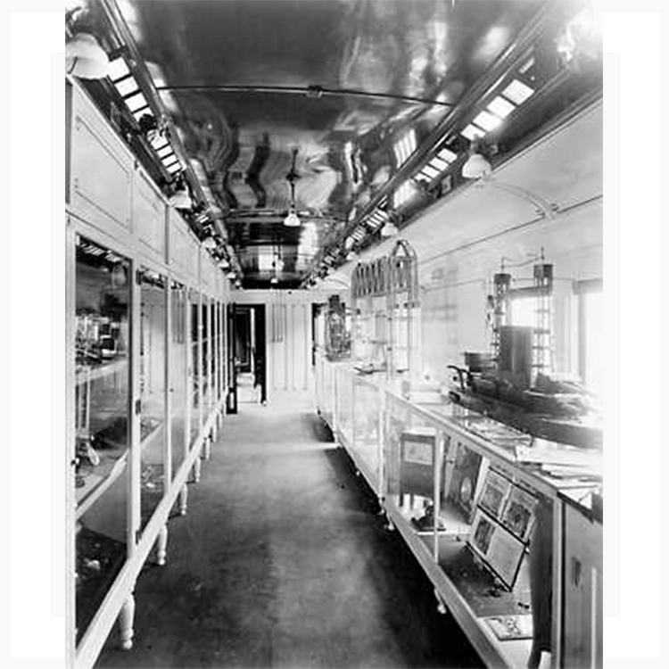
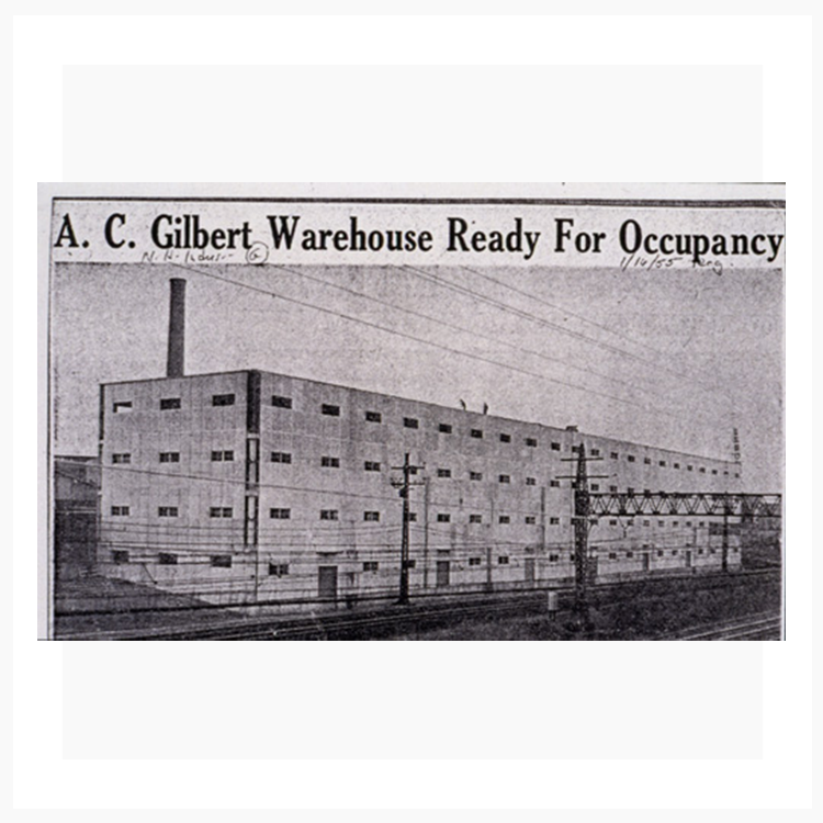
Our offices are based in the Fair Haven neighborhood in New Haven, Connecticut. Constructed in 1917 to house A.C. Gilbert's Erector Set Factory and converted into artist space starting in 1967, Erector Square is an institution in the heart of the city.1 Roche Modern has called Erector Square home since 2019, though members of our firm have been artists, fabricators, and designers here for a cumulative 40 years.
A peninsula surrounded to the West, South, and East by three different waterbodies, Fair Haven’s long history is centered around the rich potential that running water provides. Prior to European settlement Fair Haven’s fertile delta soils were used by the Quinnipiack peoples for farming and fishing. The population increased almost 100 fold over the course of the 18th century, settled by oysterman, tenement housing, and manufacturing plants. The landscape drastically changed, as the river’s resources were harnessed for transport, power, and international fishing markets. 2,3
By the 1930s the oysters were overfished. The wetlands that protected lands upstream had been stripped away. Industrial history left a number of plots contaminated with the likes of lead and PCBs. But community remained strong.
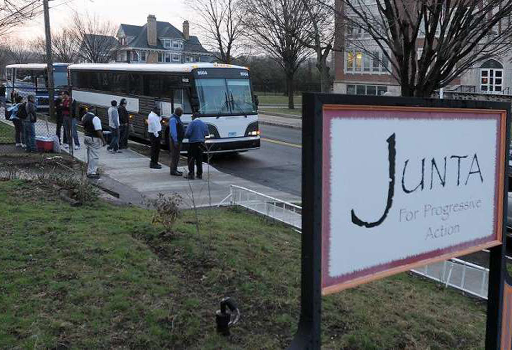
Fair Haven is one of the most populous and diverse neighborhoods in the city. Over 50 percent of the population is Hispanic, cultivating some of the most active and established community organizations—like Junta and the Puerto Rican Festival—across the city.4,5 Food, art, and culture abound on this small swath of land, which now is struggling to accommodate a growing population with quality housing.
The daily lunch-hour walk to the river is a love song to our neighborhood.
Unearthing the socio-economic
It is one of the more dense areas by population, with nearly 14,000 people per square mile…
…and a healthy mix of rental to owner ratio for the city, at 20% and 80% respectively.
With a low vacancy rate of 11%, the value for adding new housing stock is high.
Yet with the vacancy split almost 50% abandoned, 47% for rent, and 3% for sale, a major injection of capital is needed to revitalize the existing building stock.
With home values largely ranging from anywhere between $150,000 and $300,000, and a small number as low as $50,000, the neighborhood lies in a unique state of both love and blight.


Unearthing the political-physical
As architects and citizens of the built environment, we understand the myriad of ways that zoning impacts the nature of development and the physical form of our neighborhoods.6
Tools like zoning overlays, mixed use development, and resilient form-based codes offer new ways for us to construct the underlying foundations that precede the building process, shaping it from above. Explore New Haven’s interactive zoning map yourself.
Zoning can be a way to understand both the intention and the nature of a place’s present and past. As the center of the world oystering trade and a prominent industrial site at the turn of the century, Fair Haven has a number of National Register of Historic Places as well as the local Quinnipiac River Street Historic District along its south shore.
River Street Historic District is located just east of Mill River and immediately north of New Haven Harbor. It includes three multi-building industrial complexes and three individual factory buildings, ranging in age from the 1870s through the period of World War I. Of the 26 buildings in the district, there are 23 buildings, which contribute to the significance of the district and three which are non-contributing. The River Street Historic District was listed on the National Register of Historic Places in 1989.
New Haven Preservation Trust
Yet code is always intended to remain in dialogue with plans for the future. Explore one such plan for our site prepared by the city 20 years ago…
In 2002, the Economic Development and City Plan Departments prepared, and the New Haven Development Commission approved, the River Street Municipal Development Plan (MDP). The plan’s objectives include: the redevelopment of vacant land and buildings; the restoration / adaptive reuse of historic buildings; the development of a waterfront park; the improvement of the public infrastructure; and the implementation of standards to create an appealing and sustainable environment. The project area, historically used for commercial and industrial purposes, is set between two major parks and contains an industrial historic district consisting of late 19th and early 20th century buildings. Within this area, the plan identifies 25 acres consisting of 11 properties, which the city will acquire, remediate if needed, and dispose of to eligible businesses and developers. The plan sets strict standards that will assure tasteful and responsible development of designated sites, and provides for assistance to existing commercial and industrial property owners in improving their buildings. Renovation and adaptive reuse of the historic buildings, including the Bigelow Boiler manufacturing complex, is a key goal of the plan. Artist live/work spaces and professional offices are well suited to this site.
New Haven Planning Department
Unearthing the nature-ecology
The river is dynamic in form and function. Said to be a “a huge dragon meandering up through the salt meadows, twisted and turned” by the Quinnipiac peoples, the river is designed to ebb and flow.
Water breathes life into humanity. We have been drawn to its riches since our earliest days. But as we have filled its soft edges to make way for development, and as sea levels rise with warmer waters, it will take collective creativity to rewrite the story again between people and water.
REFERNECES
1 Girders and Gears. History of the Erector Set. www.girdersandgears.com/erector-type3.html
2 New Haven Preservation Trust www.nhpt.org/quinnipiac-river
3 Yale New Haven Teachers Institute. Fair Haven: An Historical and Ecological Field Study. www.teachersinstitute.yale.edu/curriculum/units/1979/3/79.03.05.x.html
4 Junta for Progressive Action. www.juntainc.org
5 Puerto Rican Festival of New Haven. www.pruinc.org/puerto-rican-festival
6 Zoning Laws (one of many pieces to peruse on the subject). www.neighborhoods.com/blog/zoning-laws-and-how-they-affect-your-neighborhood
Image Credit Eli Whitney Museum. www.eliwhitney.org/7/museum/-gilbert-project/-collections/erector-square
Image Credit A.C. Gilbert Family. www.rfgco.com/history/gilbertfamily/acg-05.htm


